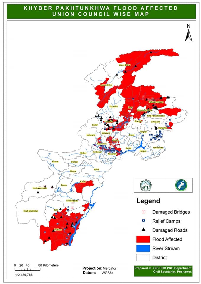
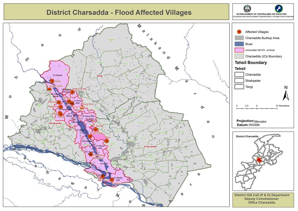
On the instructions of Chief Minister Khyber Pakhtunkhwa, Mr Mehmood Khan, the GIS Hub of the Planning and Development Department conducted satellite mapping of the flood-affected areas across the province to assist the district administration and other institutions in recovery activities after the recent floods. The areas assigned on the map included affected bridges, roads, schools, and the name and locations of the relief camps. The GIS Hub has also deployed its experts in the flood control room to assist in monitoring the flood and relief activities.